
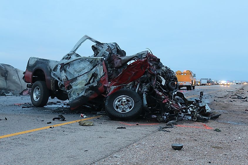
Driving across the United States offers some of the most scenic routes in the world, but it also forces commuters and road-trippers to navigate incredibly hazardous stretches of asphalt.
The Deadliest Highways By the Numbers
When analyzing data from the National Highway Traffic Safety Administration (NHTSA) and the Fatality Analysis Reporting System (FARS), a clear picture emerges of the country’s most perilous corridors.
The danger on these roads is rarely due to a single flaw. Instead, it is a perfect storm of massive commercial truck volume, high speed limits, severe seasonal weather, and dense commuter congestion mixed with out-of-town tourists.
The following breakdown highlights the absolute most dangerous freeways in America by the numbers.
The Top 3 Most Dangerous Freeways in America
1. Interstate 95 (I-95): The Deadliest by Volume
Why I-95 Is So Dangerous
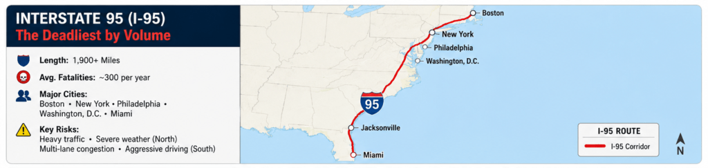
Spanning over 1,900 miles from the Canadian border in Maine all the way down to Miami, Florida, I-95 is the busiest north-south artery on the East Coast.
Because it cuts through highly populated metropolitan centers, including Boston, New York, Philadelphia, Washington D.C., and Miami, it bears an immense traffic burden.
Key Risk Factors
NHTSA data routinely identifies I-95 as the deadliest highway in America by pure volume, averaging close to 300 fatalities annually.
The danger shifts with geography: the northeast sections present severe hazards during winter freeze-and-thaw cycles, while the South Florida stretches (particularly around Miami and Jacksonville) suffer from extreme multi-lane congestion and aggressive lane-weaving.
2. Interstate 4 (I-4): The Highest Fatality Rate
America’s Most Dangerous Highway Per Mile
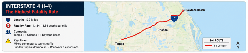
While I-95 claims the most lives due to its sheer length, Florida’s Interstate 4 holds the notorious title of the highest fatality rate per mile in the country.
Why the Crash Rate Is So High
Running just 132 miles across the center of the Sunshine State from Tampa to Daytona Beach, I-4 logs an average of 1.134 to 1.54 deaths per mile, depending on the multi-year data window analyzed.
The corridor is a pressure cooker of traffic. It blends daily local commuters with millions of distracted tourists navigating their way toward Orlando’s theme parks. Sudden tropical downpours and ongoing infrastructure expansions add to the volatility.
3. Interstate 45 (I-45): The Texas Hotspot
A Short Interstate with an Outsized Danger
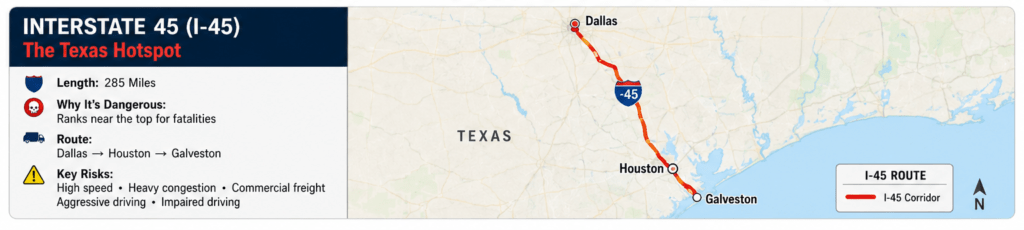
Entirely contained within the state of Texas, I-45 connects Dallas to Houston before ending in Galveston. Despite being relatively short (around 285 miles), it ranks near the absolute top of every traffic safety list.
Why the Houston Corridor Is Especially Hazardous
The Houston stretch of I-45 is particularly deadly, driven by high speed limits, intense congestion, and a heavy concentration of commercial freight vehicles heading to and from the Gulf Coast ports.
Aggressive driving behaviors and high rates of driving under the influence significantly spike the incident rates on this freeway.
Statistical Snapshot: America’s Most Dangerous Interstates
Top 5 Deadliest Interstate Corridors
The following table outlines the traditional “Top 5” deadliest corridors based on recent multi-year tracking of fatalities adjusted per 100 miles.
| Highway | Primary Regions of Risk | Major Contributing Factors |
| I-95 | Florida, North Carolina, Northeast Corridor | Extreme traffic volume, winter ice, urban merges |
| I-20 | Texas (Dallas), Georgia (Atlanta), Mississippi | Heavy commercial trucking, high speed limits |
| I-5 | California (San Diego, Los Angeles, Sacramento) | Freight corridor, severe urban commuter gridlock |
| I-75 | Florida (Tampa/Gulf Coast), Georgia, Michigan | Tourist traffic, heavy freight, severe weather shifts |
| I-35 | Texas (San Antonio, Austin, Dallas) | High density of 18-wheelers, relentless construction |
The Anatomy of a Dangerous Highway
What Makes Certain Freeways So Deadly?
When transportation engineers look at why certain freeways become accident magnets, several structural and behavioral trends surface:
Commercial Freight Corridors
Routes like I-35 and I-5 act as the literal backbone for interstate shipping. Mixing massive, slow-stopping 18-wheelers with small, fast-moving passenger vehicles inherently increases crash severity.
The “Tourist Trap” Effect
Highways like I-4 and U.S. 1 in Florida see millions of drivers who are unfamiliar with the exits, rely heavily on GPS navigation, and are prone to sudden braking or unexpected lane changes.
Infrastructure Lag
Many of these highways were designed decades ago for a fraction of today’s population. Narrow shoulders, short merge lanes, and outdated bottleneck designs struggle to handle modern traffic loads.
Defensive Driving Takeaway
Defensive Driving Takeaway: Statistically, north-south highways account for nearly 60% of these major interstate fatalities.
Whether you are driving an infamous stretch like I-4 or a major transit line like I-80, minimizing distractions and expanding your following distance around commercial trucks remains your best defense.
Stay Ready for the Unexpected on America’s Busiest Highways
Driving on some of America’s most dangerous freeways demands constant attention, whether you’re navigating the heavy traffic of I-95, the tourist-packed lanes of I-4, or the freight-heavy corridors of I-45.
Every trip is safer when you maintain a safe following distance, avoid distractions, adjust your speed to road and weather conditions, and remain aware of surrounding traffic. Even experienced drivers can encounter unexpected breakdowns, flat tires, or mechanical issues while traveling.
In those situations, having access to reliable roadside assistance can make all the difference. If you need professional towing services, tire repair services, or a mobile mechanic to get you back on the road quickly and safely, DriveSafe Solutions is ready to help.
Don’t let a roadside emergency turn into a stressful experience. Call DriveSafe Solutions today at +1 (866) 890-7355 for fast, dependable assistance wherever your journey takes you.