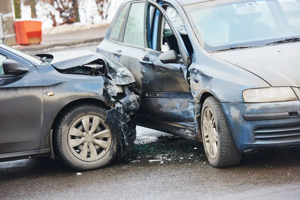
Pennsylvania features an expansive, aging highway network that handles everything from the intense urban bottlenecks of Philadelphia and Pittsburgh to the steep, weather-beaten terrains of the Appalachian Mountains.
Known as a major corridor for interstate commerce, the Keystone State connects the Eastern Seaboard to the Midwest, resulting in a heavy daily mix of local commuters and massive commercial freight haulers.
Navigating these roads can change in an instant due to sudden lake-effect snow, mountainous terrain, and legacy infrastructure designs. Staying hyper-focused during these transitions is vital, as is having the peace of mind that a reliable roadside assistance program provides when things go sideways on the asphalt.
When looking at data from the National Highway Traffic Safety Administration (NHTSA) and the Pennsylvania Department of Transportation (PennDOT), specific roadways stand out for high crash densities, high-speed trucking conflicts, and tragic fatality rates.
1. U.S. Route 1 (Roosevelt Boulevard): The Most Dangerous Surface Stretch
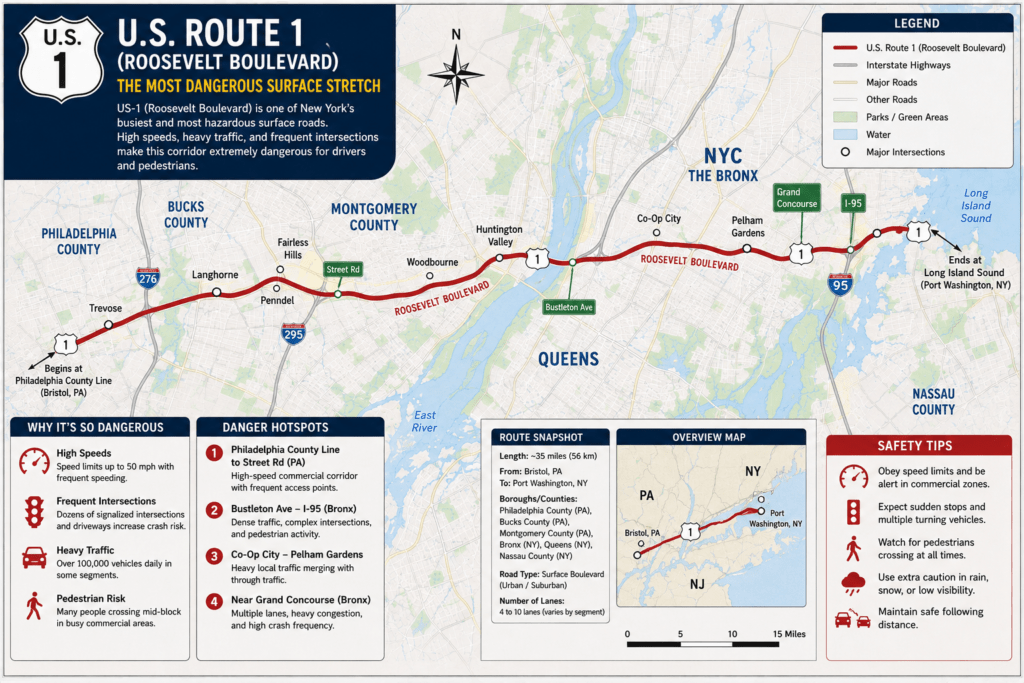
Located in Northeast Philadelphia, an 11-mile segment of Roosevelt Boulevard (specifically from West Wyoming Avenue to Hartel Avenue) is historically cited as the absolute deadliest stretch of road in the state—and one of the most dangerous in the entire country.
- The Twelve-Lane Gauntlet: Roosevelt Boulevard is a massive, complex artery featuring inner and outer express and local lanes. The configuration creates extreme confusion for out-of-town drivers, leading to aggressive lane-weaving and erratic lane changes.
- The Pedestrian Flashpoint: Unlike a closed-access interstate, this stretch cuts directly through dense residential and commercial neighborhoods. Drivers frequently exceed the 45 mph speed limit, resulting in catastrophic T-bone collisions at intersections and a disproportionately high rate of fatal pedestrian strikes.
2. Interstate 76 (The Schuylkill Expressway): “The Surekill”
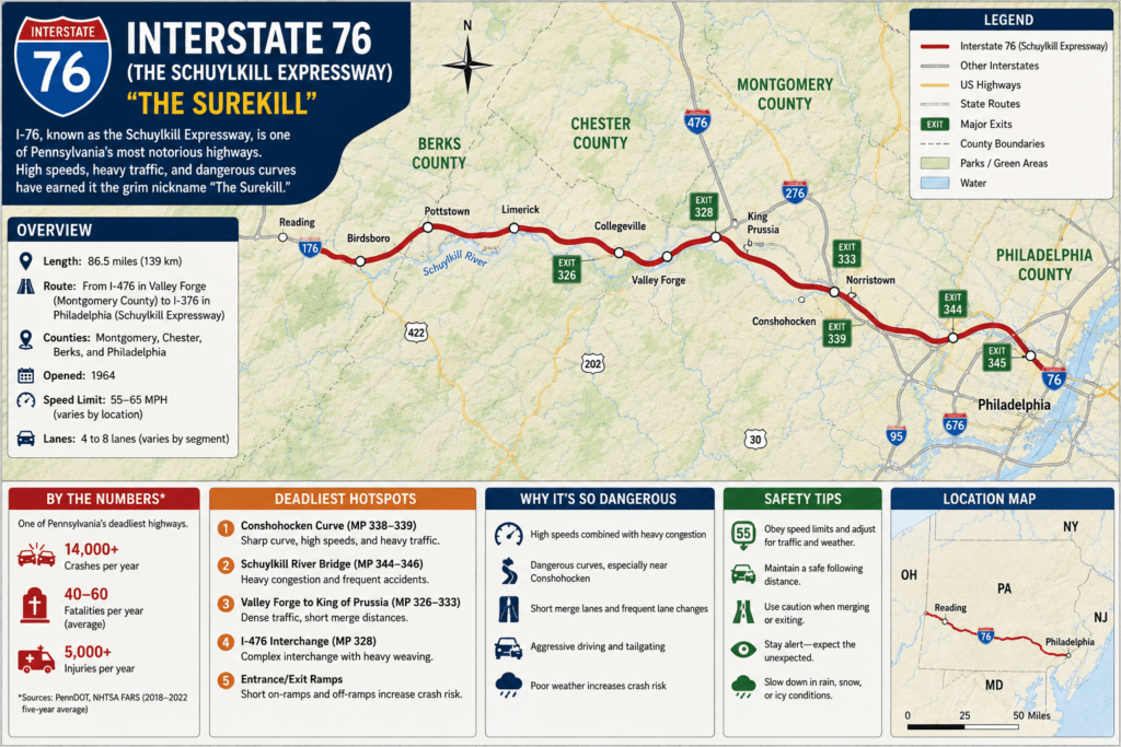
Running from the Pennsylvania Turnpike down into the heart of Philadelphia, the Schuylkill Expressway is colloquially dubbed by locals as “The Surekill Expressway” due to its notoriously stressful driving conditions.
- Outdated 1950s Design: Built to handle a fraction of its current traffic load, I-76 features incredibly narrow lanes, blind curves hugging the Schuylkill River, and minimal to non-existent emergency shoulders.
- The “Suicide Merge”: The expressway is infamous for its short, blind ramp entry points, most notably the eastbound merge at South Street, where drivers must accelerate from a dead stop directly into 65+ mph highway traffic with almost no acceleration lane. The result is a hotbed for severe rear-end pileups and side-impact collisions.
3. Interstate 80 (I-80): The Commercial Trucking Trap
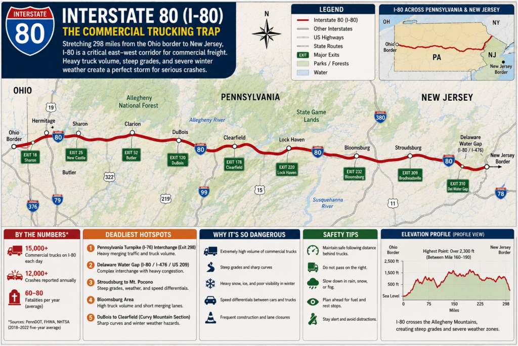
Stretching 311 miles completely across the northern tier of the state, Interstate 80 is a vital overland shipping vein connecting New York to Chicago.
- The “Cattle Chute” Freight Volume: I-80 logs an exceptionally high density of multi-axle tractor-trailers. The constant interaction between fast-moving passenger cars and heavy 80,000-pound trucks drastically escalates the severity of crashes.
- Highway Hypnosis and Weather: Because long stretches of I-80 are rural, unlit, and highly monotonous, driver fatigue is a leading cause of single-vehicle drift-off crashes. Additionally, the mountain passes are prone to rapid weather shifts, sudden winter ice, and blinding fog that frequently trigger massive chain-reaction pileups.
Statistical Overview: Pennsylvania’s High-Risk Corridors
Data compiled from state and federal accident reporting indicates that while urban centers hold the highest raw crash numbers, the state’s rural freight corridors yield significantly higher fatal outcomes per incident.
| Highway Corridor | Highest-Risk Geographic Focus | Primary Contributing Factors |
| US-1 (Roosevelt Blvd) | Philadelphia County | Extreme width, complex intersections, pedestrian hazards |
| I-76 (Schuylkill Exp) | Montgomery & Philadelphia Counties | Narrow lanes, lack of shoulders, abrupt entry merges |
| I-81 | Cumberland (Mechanicsburg) & Lackawanna | Extreme freight shipping volume, sudden mountain fog |
| I-80 | Clearfield, Centre, & Monroe Counties | Driver fatigue, winter black ice, heavy semi-truck volume |
| I-79 / I-70 Interchange | Washington County | Poor geometric design, sharp hairpin curves |
4. Interstate 81 (I-81): The Mechanicsburg-to-Scranton Hotspot
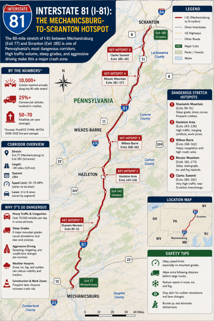
Running vertically through the state from the Maryland border up to New York, I-81 is a primary north-south alternative to the crowded I-95 corridor.
- The Cumberland County Spike: Crash statistics highlight a 20-mile stretch running from Carlisle through Mechanicsburg to Harrisburg as a major fatality zone. The rapid industrialization of this region with fulfillment warehouses, has flooded the local highway with commercial truck traffic.
- The Montage Mountain Cut: Further north near Scranton, I-81 features dramatic elevation shifts. Sudden downhill grades combined with aggressive tailgating and winter weather cause truck jackknifes and rollover accidents at an alarming rate.
5. The Interstate 79 / Interstate 70 Interchange: The Design Flaw
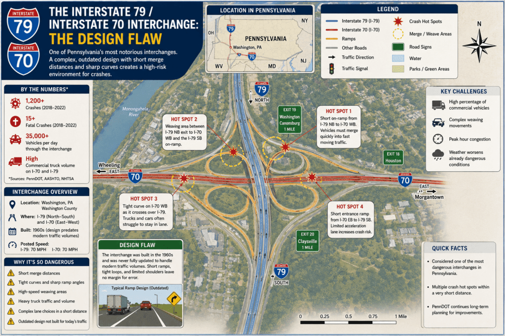
Located in Washington County near the southwestern corner of the state, the interchange connecting north-bound I-79 to I-70 is notorious among cross-country truckers and local drivers alike.
- The Hairpin Hook: To transition between the two highways, drivers must navigate an incredibly tight, sharp curve that transportation officials have frequently criticized as outdated and poorly engineered. Unfamiliar drivers entering the transition loop at standard highway speeds regularly lose control, slamming into the concrete dividing walls or triggering severe rollover wrecks.
Stay Safe on Pennsylvania’s Roads
Whether you’re facing a flat tire, a mechanical breakdown, or need emergency towing on Pennsylvania’s busiest roads, DriveSafe Solutions is ready to help. Call our toll-free number at +1 (866) 890-7355 for fast, reliable roadside assistance and get back on the road with confidence.