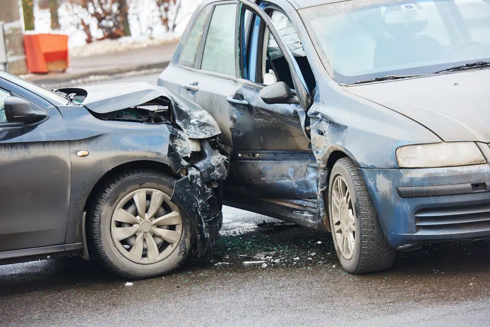
New York’s highway network presents a complex driving environment, handling everything from the hyper-congested, multi-level bottlenecks of New York City to the winding, weather-beaten corridors of upstate.
According to the Office of the New York State Comptroller and the National Highway Traffic SafetyAccording to the National Highway Traffic Safety
Administration (NHTSA), traffic fatalities in the Empire State have climbed significantly in recent years. Safely navigating this diverse terrain, especially when blinding winter lake-effect snow or sudden urban gridlock strikes, requires razor-sharp focus and the security that comes with a reliable roadside assistance plan.
While New York boasts a lower statewide fatality rate per capita than sprawling states like Texas or Florida, specific corridors within its boundaries consistently rank among the most hazardous in the region.
Here is an in-depth, data-driven look at New York’s most dangerous roads.
1. Interstate 87 (The New York State Thruway): The Deadliest Statewide
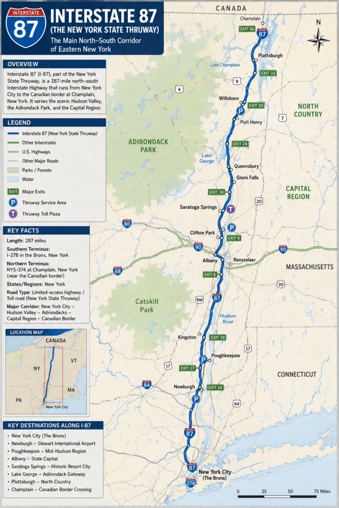
Spanning 333 miles from the Bronx all the way to the Canadian border, Interstate 87 is the literal backbone of New York transit. Multi-year crash studies frequently rank I-87 as the deadliest highway in the state by raw fatal crash volume.
- The Downstate Bottlenecks: The southern segments passing through Westchester, Rockland, and Albany counties experience immense commuter density. Tight merging zones and aggressive lane-weaving lead to frequent high-speed collisions.
- The Upstate Winter Hazard: As I-87 heads north through the Adirondacks, the threat shifts from congestion to nature. Sudden whiteouts, black ice, and a lack of overhead lighting turn this high-speed corridor into a hotbed for severe single-vehicle rollovers and multi-car pileups during the winter months.
2. Interstate 495 (The Long Island Expressway): High-Speed Suburban Friction
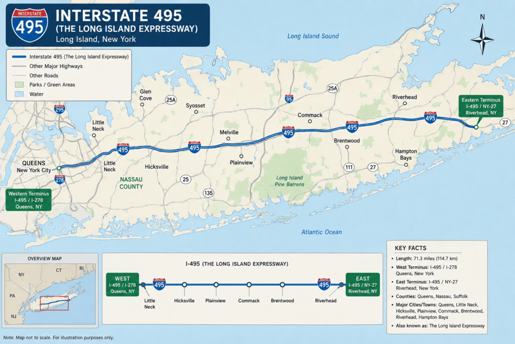
Affectionately (and frustratingly) known by locals as “the world’s longest parking lot,” the Long Island Expressway (LIE) stretches 71 miles through Queens, Nassau, and Suffolk counties.
- Extreme Speed Differentials: Despite its reputation for gridlock, during off-peak hours, the LIE becomes notoriously dangerous due to excessive speeding. Drivers frequently push past 80 mph, forcing dangerous interactions with slower traffic.
- The Suffolk County Hotspot: Suffolk County consistently logs more motor vehicle crashes and fatalities than any other county in New York State. Heavy commuter volume paired with sudden stop-and-go patterns makes interchanges like Route 25 and Maurice Avenue notorious accident zones.
3. The Taconic State Parkway: Beautiful but Outdated Design
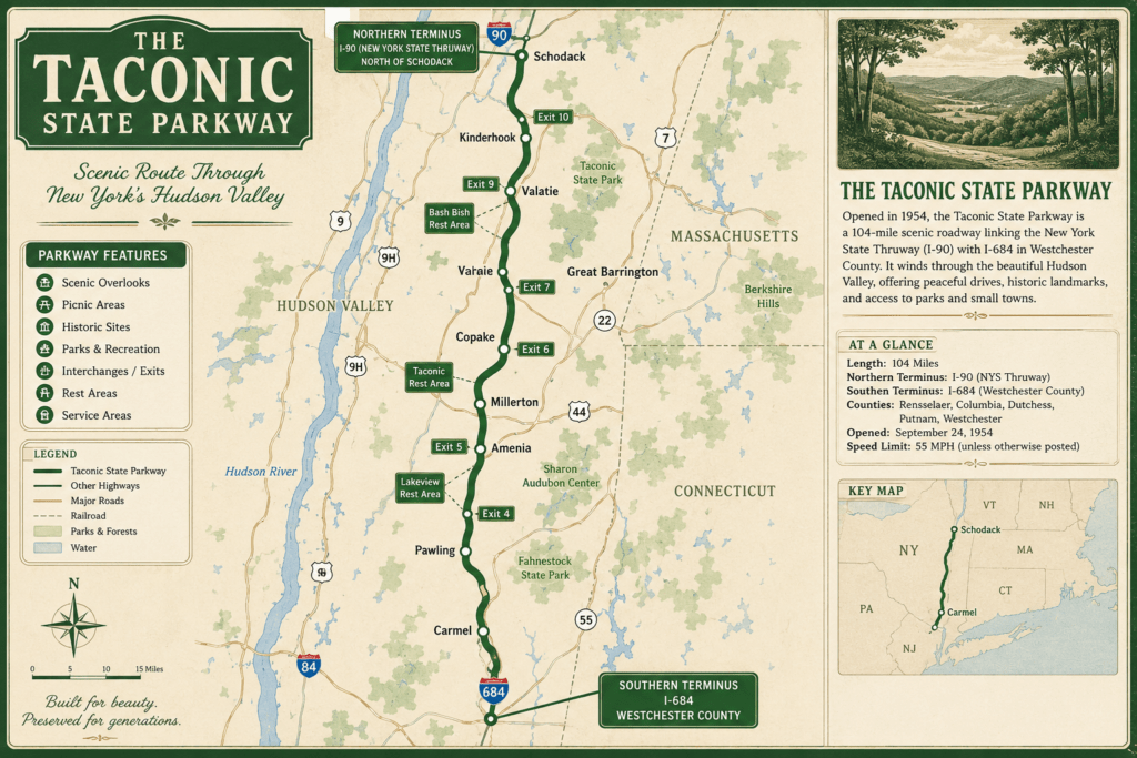
Winding through the scenic Hudson Valley, the Taconic State Parkway is visually stunning but structurally unforgiving.
- 1930s Infrastructure Lag: Designed in an era when cars traveled at much slower speeds, the Taconic features narrow lanes, sharp blind curves, and minimal to nonexistent shoulders.
- Zero Margin for Error: At modern speed limits, the parkway’s missing physical medians in older sections and abrupt at-grade intersections create a high risk for devastating head-on collisions and drift-off-road accidents, particularly during heavy rain or freezing night conditions.
Statistical Overview: New York’s High-Risk Corridors
Data compiled from federal and state tracking highlights how infrastructure age and regional density shape the risk profile of New York’s primary roadways.
| Highway Corridor | Highest-Risk Geographic Segments | Primary Contributing Factors |
| I-87 (Thruway) | Bronx, Rockland, & Albany Counties | Tailgating, heavy commercial trucks, winter ice |
| I-495 (LIE) | Suffolk & Nassau Counties (Long Island) | Severe congestion, aggressive lane-changing, speeding |
| Taconic Parkway | Westchester & Dutchess Counties | Narrow lanes, sharp curves, lack of emergency shoulders |
| I-95 (Cross Bronx) | Upper Manhattan & The Bronx | Extreme bottlenecking, bridge-approach merging friction |
| SR-27 (Sunrise Hwy) | Suffolk County | High-speed suburban traffic mixed with pedestrian crossings |
4. Interstate 95 (The Cross Bronx Expressway): The Ultimate Urban Bottleneck
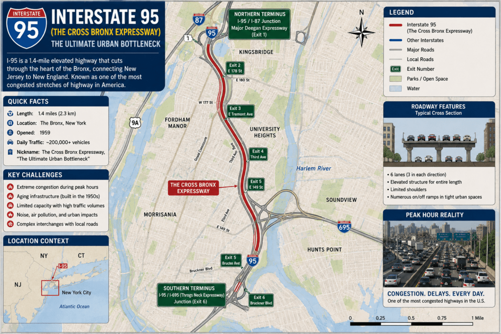
Though New York’s portion of I-95 is relatively short, spanning just over 23 miles, it contains some of the most stressful and accident-prone asphalt in the nation.
- The Bridge Approaches: Independent traffic safety groups have frequently pinpointed the approaches to the Alexander Hamilton Bridge and the George Washington Bridge as national crash hotspots.
- Compressed Merging: Massive commercial 18-wheelers, local delivery box trucks, and daily commuters are forced into tightly compressed, multi-lane merges. The resulting friction causes thousands of sideswipes and rear-end collisions annually.
5. Queens Boulevard & Suburban Arterials: The Pedestrian Danger
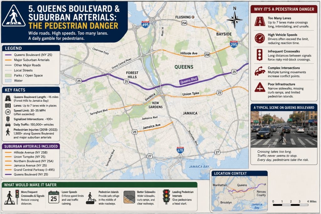
Outside of the traditional closed-access interstates, New York features highly dangerous multi-lane arterial roads.
- Queens Boulevard: Historically dubbed the “Boulevard of Death,” this massive, 12-lane NYC thoroughfare has seen major safety overhauls under city “Vision Zero” initiatives. However, its complex traffic light cycles and sheer width keep it highly volatile for both drivers and pedestrians.
- Sunrise Highway (State Route 27) & Hempstead Turnpike: Located on Long Island, these sprawling roads function as hybrids between high-speed highways and commercial local streets. The lethal combination of 55+ mph vehicle speeds, frequent strip-mall driveways, and pedestrians attempting to cross multi-lane expanses creates an exceptionally high rate of severe traffic fatalities.
We Offer 24/7 Roadside Assistance Across New York
Need roadside assistance anywhere in New York? Whether you’re dealing with a breakdown, a flat tire, or need towing services, DriveSafe Solutions is ready to help. Call our toll-free number at +1 (866) 890-7355 for fast, reliable service whenever you need it.